How Trump’s National Weather Service Cuts Could Cost Lives
May 13, 20258 min readHow Trump’s National Weather Service Cuts Could Cost LivesWeather experts warn that staff cuts at the National Weather Service that have been made by the Trump administration are a danger to public safety as tornadoes, hurricanes and heat loom this spring and summerBy Andrea Thompson edited by Dean VisserA house submerged in floodwaters, inPointe-Aux-Chenes, Terrebonne Parish, La.
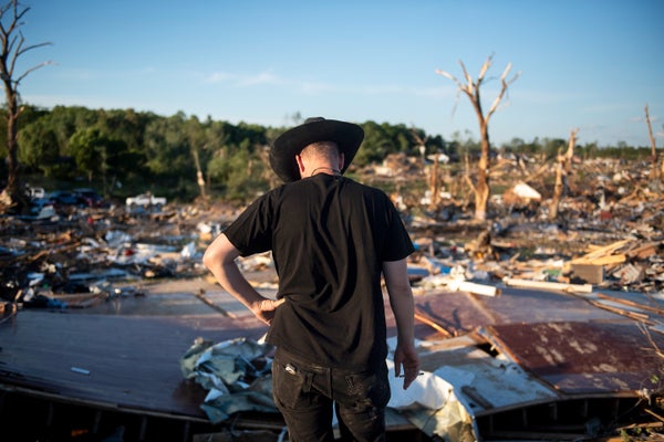
Mark Felix/Bloomberg/Getty ImagesJust more than 100 years ago, on March 18, 1925, a tornado slashed across the U.S.
Midwest with no warning at all and killed 695 people—a massive number for a single outbreak.
Today those in a twister’s path get a take-cover notice eight to 18 minutes before a strike on average.
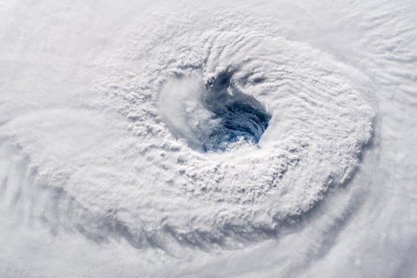
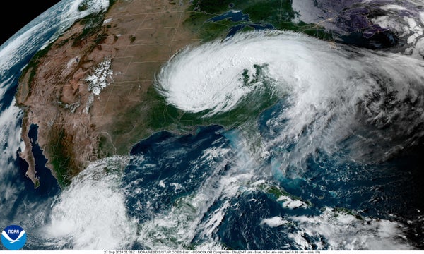
And as recently as 1992, what looked like a minor tropical disturbance intensified with shocking speed into Hurricane Andrew.
There was little time to prepare for the storm, and much of the resulting property damage in South Florida was massive.
But by last year, forecasters could give several days’ warning that the then approaching storms Helene and Milton were likely to abruptly morph into monsters.Such improvements have cumulatively saved thousands of lives and likely hundreds of billions of dollars across the U.S.
And they happened only through concerted federal government investment in studying weather events, improving computer forecast models, and making continent- and ocean-spanning efforts to collect the data that make those forecasts possible.
Now meteorology experts are urgently warning that the Trump administration’s staff firings and funding cuts at the National Weather Service (and its parent, the National Oceanic and Atmospheric Administration) threaten to disrupt these crucial operations and turn back the clock on forecasting.“Our worst nightmare is that weather forecast offices will be so understaffed that there will be needless loss of life,” wrote five former NWS directors from both Democratic and Republican administrations in an open letter on May 2.On supporting science journalismIf you're enjoying this article, consider supporting our award-winning journalism by subscribing.
By purchasing a subscription you are helping to ensure the future of impactful stories about the discoveries and ideas shaping our world today.Ultimately, storm experts say, disruption caused by existing and proposed cuts will hit multiple fronts.
An understaffed and underfunded NWS could mean that a tornado warning doesn’t come in time, that a hurricane forecast is off just enough so that the wrong coastal areas are evacuated or that flights are less likely to be routed around turbulence.
“The net result is going to be massive economic harm,” said climate scientist Daniel Swain during one of his regular talks hosted on YouTube.
“As we break these things, eventually it will become painfully and unignorably obvious what we’ve broken and how important it was.
And it’s going to be unbelievably expensive in the scramble to try and get it back—and we might not be able to get it back.”The NWS’s budget pays for weather services that benefit industryFor the past 20 years, a little more than 4,000 NWS staff members have put together 24-7 forecasts for the country’s approximately 300 million people every day of the year.
“We have [a more] efficient level of [staff compared] to the number of people we’re serving than any other country in the world by two orders of magnitude,” says Louis Uccellini, who was NWS director from 2013 to 2022 and signed the open letter.The NWS punches above its economic weight, too: it costs the average American about $4 per year.
“It’s a cup of coffee,” says JoAnn Becker, president of the National Weather Service Employees Organization, a union that represents the NWS and several NOAA offices.
With one third of the U.S.
economy—from farming to trucking to tourism—being sensitive to weather and climate, the NWS provides an overall benefit of $100 billion to the economy.
This is roughly 10 times what the service costs to run, according to an American Meteorological Society white paper.
Recent improvements to hurricane forecasts alone have saved up to $5 billion for each hurricane that hit the U.S.
since 2007, according to a report by the National Bureau of Economic Research—a nonpartisan, nonprofit economic research organization.
In comparison, the NWS’s entire budget for 2024 was less than $1.4 billion.NOAA Hurricane Hunters (L-R) Lt.
Cmdr.
Chris Wood, Flight Engineer Rusty Dittoe, and Hurricane Aircraft Commander Adam Arbitbol flies towards Tropical Storm Debby on Aug.
3, 2024.Luis Santana/Tampa Bay Times via ZUMA Press Wire/Alamy Stock PhotoWith the growing number of disasters that cost the country $1 billion or more in damages, weather experts have advocated for increasing the agency’s staff and budget.
“NOAA is a $12-billion agency trapped in a $5-and-a-half-billion budget,” said Craig McLean, then acting chief scientist of NOAA, in testimony to Congress three years ago.Even before President Donald Trump took office, the NWS was already about 5 percent below the staffing level the service has considered adequate as it scrambled to catch up to a spate of retirements.
After the NWS’s first wave of firings and early retirements under the Trump administration, staffing at the service’s 122 field offices across the country has dropped to a 19 percent vacancy rate.
Fifty-two offices are now considered “critically understaffed,” meaning a shortage of more than 20 percent.
Some branches are down by more than 40 percent.
“We’re small offices,” Becker says.
Each weather forecast office has about 25 to 30 people.
“When you’re down four people, it starts to hurt,” she adds.
“There comes a point where you don’t have enough people to cover everything.”The lack of noticeable degradations in forecast quality so far is “because of the valiant efforts of the people who remain in these now critically understaffed roles in field offices,” Swain said in his recent video.
“But the cracks are really now starting to show.”Concerns raised over balloon launches, radar and Hurricane Hunters One of the most noticeable effects of the staffing shortage has been the sharp reductions—and even cancellations—of the weather balloon launches that are supposed to happen twice a day at every forecast office across the country.
These launches all happen at the same time to give forecasters a three-dimensional snapshot of the atmosphere.
Those data are then fed into weather models and are crucial to making sure the models start with the most accurate possible information.
This is particularly true during tornado outbreaks or prior to a hurricane landfall.
For the former, forecasters need to understand the atmospheric patterns that influence an outbreak to better pinpoint where tornadoes might spin up.
And understanding atmospheric patterns over the country is critical to forecasting where a hurricane will make landfall.
The lack of balloon launches “is going to degrade weather forecasts to some extent,” Swain said in his video.
“And the effects may not be obvious until there’s a major tornado outbreak or hurricane landfall downwind that doesn’t go so well.”The suspensions and cancellations might be somewhat less worrisome if they were evenly spread out, but they are largely clustered in the center of the country—right upwind from Tornado Alley.
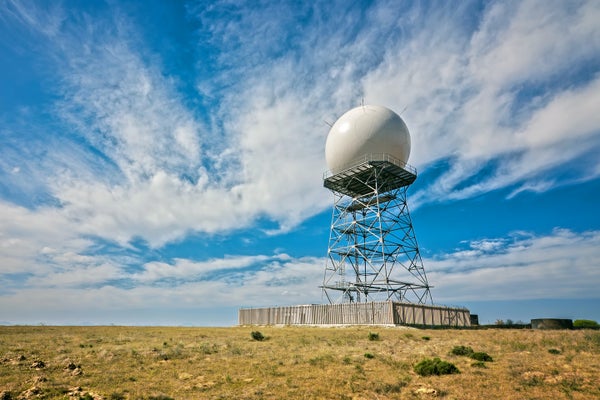
The fact that a function as essential as balloon launches is being cut is a clear sign of how much staff are feeling the crunch, Swain said.The map shows where weather balloon launches continued as normal (black), have been curtailed (orange) or have been suspended entirely (red).Chris Vagasky, created with OpenStreetMap data (CC BY 2.0)Another concern regards forecasting equipment, such as the nation’s Doppler radar system, which is the only tool that forecasters can use to spot tornadoes inside storms systems, allowing for better warnings.
Staffing cuts and spending freezes mean that if any radars or other equipment go down, offices may not have the staff or money to repair them, Becker and others say.Experts are also concerned about the firings of two of NOAA’s Hurricane Hunters—members of the crew that flies aircraft, crammed with state-of-the-art equipment, into the middle of tropical storms and hurricanes to gather data.
Research has shown that including these data clearly makes hurricane forecasts more accurate and reliable.
Diminished crews mean some flights could be cancelled, leaving coastal communities more vulnerable to approaching storms.The NWS also issues specific aviation, shipping and space weather forecasts—all under threat from the current and proposed cuts.Some of the NWS offices will become so short-staffed that they may have to operate part-time, the agency’s former directors warned in their open letter.
This could include making fewer highly tailored forecasts, as well as performing less outreach on social media and to local officials and emergency managers.
Such outreach has been a major goal of the NWS to make sure communities are better prepared before extreme weather hits.
The forecasters in the NWS offices are “community experts” who have close working relationships with emergency managers, school districts and other local decision-makers, Becker says.
Without those proactive efforts, “you’re basically watching the storm,” Uccellini says.Being down so many people means “you have to cut corners—and cutting corners is dangerous with lives and property at stake,” says Jeff Masters, a writer at Yale Climate Connections and a former Hurricane Hunter at NOAA.
Uccellini likens what is happening to stretching a rubber band: “You can stretch and stretch it, and then it breaks,” he says.
“And when it breaks, you can’t put it back together again.”Meteorologists, associations speak out against cutsNeither artificial intelligence forecasts nor private weather companies will be able to fill in the gap; both rely on the data NOAA collects.
Without robust NOAA data collection, “the Weather Channel, Accuweather ...
will be unable to function as they have,” says Rick Spinrad, who served as NOAA administrator from 2021 to 2025.People across the vast weather community, from individual meteorologists to professional societies such as the American Meteorological Society and the National Weather Association, have all expressed alarm about the cuts to NOAA and the NWS and have urged the Trump administration to reverse course.
Industries that depend on weather and climate data, such as the insurance industry, have also spoken out.
The Union of Concerned Scientists has also sent congressional leaders an open letter to urge them to reinstate NOAA’s staffing and funding that has been signed by more than 3,300 scientists and other experts.Morale is extremely low in offices across the NWS, according to Swain’s video and to Uccellini and many others who know current employees at the agency.
Funding cuts are forcing many employees to bring in their own toilet paper and soap.
There is also “an extreme culture of fear” Swain said in his video, with “threatening and demeaning communications” from agency leaders that have called employees “lazy” and “low productivity.”“Our worst nightmare is that weather forecast offices will be so understaffed that there will be needless loss of life." —Five former NWS directors in a May 2 open letterIn their open letter, the former NWS directors contradicted this characterization, speaking of the dedication of the agency’s employees: “They will often sleep in weather forecast offices to make sure poor weather conditions don’t stop them from being on time for their shifts to do their critical work.
They stay at their stations during hurricanes, tornadoes and other severe storms, even when extreme weather affects their own families.”The implemented and proposed cuts indicate that those making them have little understanding of how the service works and have not taken time to look for actual inefficiencies, Spinrad and Masters say.
Swain and others have concurred.
Instead, Spinrad says, the Trump administration has made “easy” cuts such as firing “probationary” employees (those who were newly hired or recently promoted, making them easier to fire).
This approach “is trying to use a chainsaw instead of a scalpel to fix the patient” in terms of addressing bureaucratic inefficiencies, Masters says.In response to a detailed list of questions regarding the cuts, the concerns others have expressed about their ramifications and the Trump administration’s willingness to abide by any budget set by Congress from Scientific American, the NWS’s press office wrote, “The National Weather Service is adjusting some services due to temporary staffing changes at our local forecast offices throughout the country in order to best meet the needs of the public, our partners and stakeholders in each office’s local area.
These adjustments are also temporary and we will continue to fulfill our core mission of providing life-saving forecasts, warnings, and decision support services.”“In an era of climate change causing increased extreme weather, we should be spending more on NOAA and the National Weather Service, not less,” Masters says.
“This is a very poor way to spend our tax dollars.”
المصدر:
https://www.scientificamerican.com/article/how-trumps-national-weather-service-cuts-could-cost-lives/
#How #Trumps #National #Weather #Service #Cuts #Could #Cost #LivesHow Trump’s National Weather Service Cuts Could Cost Lives
May 13, 20258 min readHow Trump’s National Weather Service Cuts Could Cost LivesWeather experts warn that staff cuts at the National Weather Service that have been made by the Trump administration are a danger to public safety as tornadoes, hurricanes and heat loom this spring and summerBy Andrea Thompson edited by Dean VisserA house submerged in floodwaters, inPointe-Aux-Chenes, Terrebonne Parish, La.
Mark Felix/Bloomberg/Getty ImagesJust more than 100 years ago, on March 18, 1925, a tornado slashed across the U.S.
Midwest with no warning at all and killed 695 people—a massive number for a single outbreak.
Today those in a twister’s path get a take-cover notice eight to 18 minutes before a strike on average.
And as recently as 1992, what looked like a minor tropical disturbance intensified with shocking speed into Hurricane Andrew.
There was little time to prepare for the storm, and much of the resulting property damage in South Florida was massive.
But by last year, forecasters could give several days’ warning that the then approaching storms Helene and Milton were likely to abruptly morph into monsters.Such improvements have cumulatively saved thousands of lives and likely hundreds of billions of dollars across the U.S.
And they happened only through concerted federal government investment in studying weather events, improving computer forecast models, and making continent- and ocean-spanning efforts to collect the data that make those forecasts possible.
Now meteorology experts are urgently warning that the Trump administration’s staff firings and funding cuts at the National Weather Service (and its parent, the National Oceanic and Atmospheric Administration) threaten to disrupt these crucial operations and turn back the clock on forecasting.“Our worst nightmare is that weather forecast offices will be so understaffed that there will be needless loss of life,” wrote five former NWS directors from both Democratic and Republican administrations in an open letter on May 2.On supporting science journalismIf you're enjoying this article, consider supporting our award-winning journalism by subscribing.
By purchasing a subscription you are helping to ensure the future of impactful stories about the discoveries and ideas shaping our world today.Ultimately, storm experts say, disruption caused by existing and proposed cuts will hit multiple fronts.
An understaffed and underfunded NWS could mean that a tornado warning doesn’t come in time, that a hurricane forecast is off just enough so that the wrong coastal areas are evacuated or that flights are less likely to be routed around turbulence.
“The net result is going to be massive economic harm,” said climate scientist Daniel Swain during one of his regular talks hosted on YouTube.
“As we break these things, eventually it will become painfully and unignorably obvious what we’ve broken and how important it was.
And it’s going to be unbelievably expensive in the scramble to try and get it back—and we might not be able to get it back.”The NWS’s budget pays for weather services that benefit industryFor the past 20 years, a little more than 4,000 NWS staff members have put together 24-7 forecasts for the country’s approximately 300 million people every day of the year.
“We have [a more] efficient level of [staff compared] to the number of people we’re serving than any other country in the world by two orders of magnitude,” says Louis Uccellini, who was NWS director from 2013 to 2022 and signed the open letter.The NWS punches above its economic weight, too: it costs the average American about $4 per year.
“It’s a cup of coffee,” says JoAnn Becker, president of the National Weather Service Employees Organization, a union that represents the NWS and several NOAA offices.
With one third of the U.S.
economy—from farming to trucking to tourism—being sensitive to weather and climate, the NWS provides an overall benefit of $100 billion to the economy.
This is roughly 10 times what the service costs to run, according to an American Meteorological Society white paper.
Recent improvements to hurricane forecasts alone have saved up to $5 billion for each hurricane that hit the U.S.
since 2007, according to a report by the National Bureau of Economic Research—a nonpartisan, nonprofit economic research organization.
In comparison, the NWS’s entire budget for 2024 was less than $1.4 billion.NOAA Hurricane Hunters (L-R) Lt.
Cmdr.
Chris Wood, Flight Engineer Rusty Dittoe, and Hurricane Aircraft Commander Adam Arbitbol flies towards Tropical Storm Debby on Aug.
3, 2024.Luis Santana/Tampa Bay Times via ZUMA Press Wire/Alamy Stock PhotoWith the growing number of disasters that cost the country $1 billion or more in damages, weather experts have advocated for increasing the agency’s staff and budget.
“NOAA is a $12-billion agency trapped in a $5-and-a-half-billion budget,” said Craig McLean, then acting chief scientist of NOAA, in testimony to Congress three years ago.Even before President Donald Trump took office, the NWS was already about 5 percent below the staffing level the service has considered adequate as it scrambled to catch up to a spate of retirements.
After the NWS’s first wave of firings and early retirements under the Trump administration, staffing at the service’s 122 field offices across the country has dropped to a 19 percent vacancy rate.
Fifty-two offices are now considered “critically understaffed,” meaning a shortage of more than 20 percent.
Some branches are down by more than 40 percent.
“We’re small offices,” Becker says.
Each weather forecast office has about 25 to 30 people.
“When you’re down four people, it starts to hurt,” she adds.
“There comes a point where you don’t have enough people to cover everything.”The lack of noticeable degradations in forecast quality so far is “because of the valiant efforts of the people who remain in these now critically understaffed roles in field offices,” Swain said in his recent video.
“But the cracks are really now starting to show.”Concerns raised over balloon launches, radar and Hurricane Hunters One of the most noticeable effects of the staffing shortage has been the sharp reductions—and even cancellations—of the weather balloon launches that are supposed to happen twice a day at every forecast office across the country.
These launches all happen at the same time to give forecasters a three-dimensional snapshot of the atmosphere.
Those data are then fed into weather models and are crucial to making sure the models start with the most accurate possible information.
This is particularly true during tornado outbreaks or prior to a hurricane landfall.
For the former, forecasters need to understand the atmospheric patterns that influence an outbreak to better pinpoint where tornadoes might spin up.
And understanding atmospheric patterns over the country is critical to forecasting where a hurricane will make landfall.
The lack of balloon launches “is going to degrade weather forecasts to some extent,” Swain said in his video.
“And the effects may not be obvious until there’s a major tornado outbreak or hurricane landfall downwind that doesn’t go so well.”The suspensions and cancellations might be somewhat less worrisome if they were evenly spread out, but they are largely clustered in the center of the country—right upwind from Tornado Alley.
The fact that a function as essential as balloon launches is being cut is a clear sign of how much staff are feeling the crunch, Swain said.The map shows where weather balloon launches continued as normal (black), have been curtailed (orange) or have been suspended entirely (red).Chris Vagasky, created with OpenStreetMap data (CC BY 2.0)Another concern regards forecasting equipment, such as the nation’s Doppler radar system, which is the only tool that forecasters can use to spot tornadoes inside storms systems, allowing for better warnings.
Staffing cuts and spending freezes mean that if any radars or other equipment go down, offices may not have the staff or money to repair them, Becker and others say.Experts are also concerned about the firings of two of NOAA’s Hurricane Hunters—members of the crew that flies aircraft, crammed with state-of-the-art equipment, into the middle of tropical storms and hurricanes to gather data.
Research has shown that including these data clearly makes hurricane forecasts more accurate and reliable.
Diminished crews mean some flights could be cancelled, leaving coastal communities more vulnerable to approaching storms.The NWS also issues specific aviation, shipping and space weather forecasts—all under threat from the current and proposed cuts.Some of the NWS offices will become so short-staffed that they may have to operate part-time, the agency’s former directors warned in their open letter.
This could include making fewer highly tailored forecasts, as well as performing less outreach on social media and to local officials and emergency managers.
Such outreach has been a major goal of the NWS to make sure communities are better prepared before extreme weather hits.
The forecasters in the NWS offices are “community experts” who have close working relationships with emergency managers, school districts and other local decision-makers, Becker says.
Without those proactive efforts, “you’re basically watching the storm,” Uccellini says.Being down so many people means “you have to cut corners—and cutting corners is dangerous with lives and property at stake,” says Jeff Masters, a writer at Yale Climate Connections and a former Hurricane Hunter at NOAA.
Uccellini likens what is happening to stretching a rubber band: “You can stretch and stretch it, and then it breaks,” he says.
“And when it breaks, you can’t put it back together again.”Meteorologists, associations speak out against cutsNeither artificial intelligence forecasts nor private weather companies will be able to fill in the gap; both rely on the data NOAA collects.
Without robust NOAA data collection, “the Weather Channel, Accuweather ...
will be unable to function as they have,” says Rick Spinrad, who served as NOAA administrator from 2021 to 2025.People across the vast weather community, from individual meteorologists to professional societies such as the American Meteorological Society and the National Weather Association, have all expressed alarm about the cuts to NOAA and the NWS and have urged the Trump administration to reverse course.
Industries that depend on weather and climate data, such as the insurance industry, have also spoken out.
The Union of Concerned Scientists has also sent congressional leaders an open letter to urge them to reinstate NOAA’s staffing and funding that has been signed by more than 3,300 scientists and other experts.Morale is extremely low in offices across the NWS, according to Swain’s video and to Uccellini and many others who know current employees at the agency.
Funding cuts are forcing many employees to bring in their own toilet paper and soap.
There is also “an extreme culture of fear” Swain said in his video, with “threatening and demeaning communications” from agency leaders that have called employees “lazy” and “low productivity.”“Our worst nightmare is that weather forecast offices will be so understaffed that there will be needless loss of life." —Five former NWS directors in a May 2 open letterIn their open letter, the former NWS directors contradicted this characterization, speaking of the dedication of the agency’s employees: “They will often sleep in weather forecast offices to make sure poor weather conditions don’t stop them from being on time for their shifts to do their critical work.
They stay at their stations during hurricanes, tornadoes and other severe storms, even when extreme weather affects their own families.”The implemented and proposed cuts indicate that those making them have little understanding of how the service works and have not taken time to look for actual inefficiencies, Spinrad and Masters say.
Swain and others have concurred.
Instead, Spinrad says, the Trump administration has made “easy” cuts such as firing “probationary” employees (those who were newly hired or recently promoted, making them easier to fire).
This approach “is trying to use a chainsaw instead of a scalpel to fix the patient” in terms of addressing bureaucratic inefficiencies, Masters says.In response to a detailed list of questions regarding the cuts, the concerns others have expressed about their ramifications and the Trump administration’s willingness to abide by any budget set by Congress from Scientific American, the NWS’s press office wrote, “The National Weather Service is adjusting some services due to temporary staffing changes at our local forecast offices throughout the country in order to best meet the needs of the public, our partners and stakeholders in each office’s local area.
These adjustments are also temporary and we will continue to fulfill our core mission of providing life-saving forecasts, warnings, and decision support services.”“In an era of climate change causing increased extreme weather, we should be spending more on NOAA and the National Weather Service, not less,” Masters says.
“This is a very poor way to spend our tax dollars.”
المصدر: https://www.scientificamerican.com/article/how-trumps-national-weather-service-cuts-could-cost-lives/
#How #Trumps #National #Weather #Service #Cuts #Could #Cost #Lives